Difficulty:
Easy
Duration:
8 or 9 days
Scenery:
Very good
Traffic:
High
Key Facts
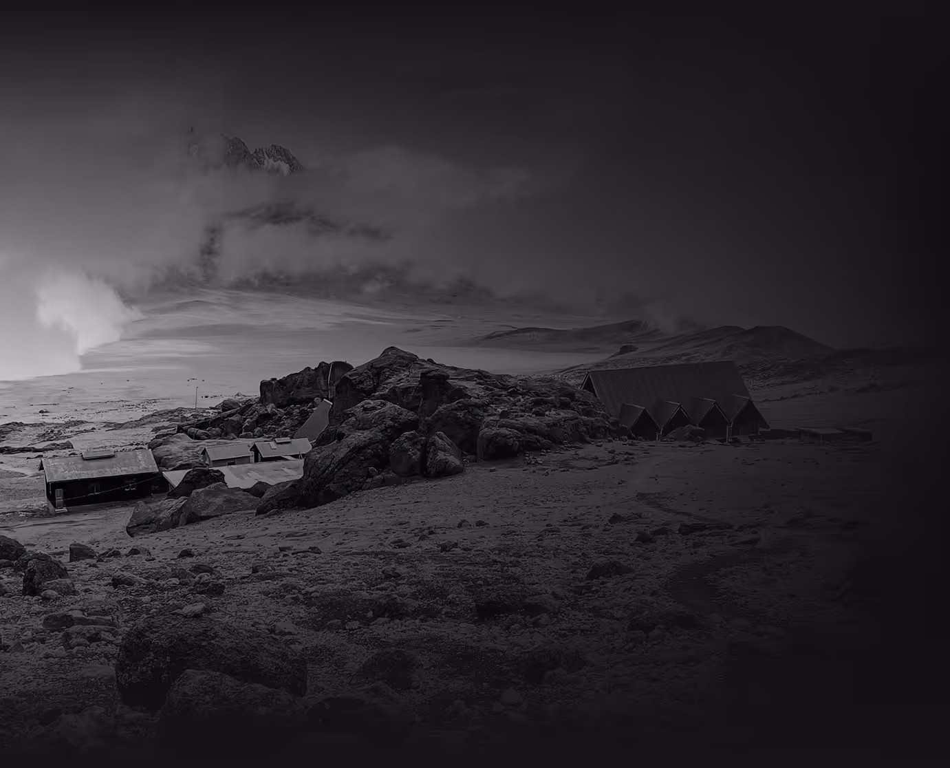
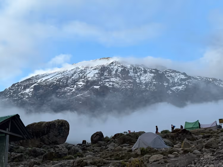
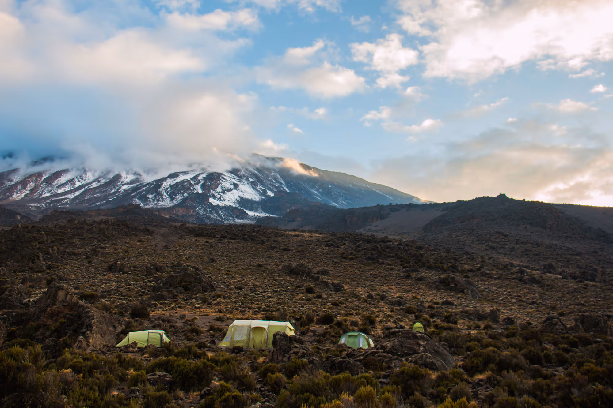
The Northern Circuit route is one of the best routes on Kilimanjaro, offering nearly 360 degrees of beautiful scenery including the quiet, rarely visited northern slopes. As the longest route on Kilimanjaro, the Northern Circuit also has the most acclimatization time and the highest summit success rate. Thus, the Northern Circuit route is highly recommended.
The route approaches Mount Kilimanjaro from the west, beginning with a long drive from Moshi to Londorossi Gate. From there, the first two days are spent trekking through the rainforest to Shira Ridge, before crossing the Shira Plateau. The route then heads north and circles clockwise from Moir Hut to Buffalo Camp to School Hut, before summiting from the east. Descend is made via the Mweka route.
EXTRAORDINARY REMOTE TRAIL AND WILDLIFE OPPORTUNITIES
The Northern Circuit takes climbers along the rarely-used northern slopes of Kilimanjaro, providing a remote and peaceful journey with incredible opportunities for wildlife spotting. This off-the-beaten-track approach offers a more isolated trekking experience, far from the usual crowds.
OPTIMAL ACCLIMATISATION WITH GRADUAL ASCENT
With a longer route and gradual elevation gain, the Northern Circuit allows climbers ample time for proper acclimatisation. The extended itinerary and the climb-high, sleep-low strategy enhance altitude adjustment, significantly boosting the chances of reaching the summit.
CAMPING IN PRISTINE ENVIRONMENTS
Climbers on the Northern Circuit camp in designated tented camps, fostering a deep connection with nature. The quieter route also offers a stronger sense of self-reliance, as trekkers experience the unspoiled beauty of Kilimanjaro's diverse ecosystems.
DIVERSE LANDSCAPES AND UNIQUE VISTAS
The Northern Circuit is renowned for its varied terrain, offering trekkers dramatic views of Kilimanjaro’s lesser-seen northern side. From lush rainforests and alpine moorlands to the expansive savannahs and stark, barren highlands, the route culminates with breathtaking views of the glaciers and the summit.
EXCEPTIONAL SUMMIT SUCCESS RATE
Thanks to its extended duration and gradual ascent, the Northern Circuit boasts one of the highest summit success rates on Kilimanjaro. The combination of proper acclimatisation and scenic, steady trekking ensures a well-balanced challenge that prepares climbers for success.


Select your itinerary
The essentials
Uncharted Summits
Pre Climb
Arrival and briefing
Distance: 12 km
Trek time: 6–7 hours
Zone: Semi-desert
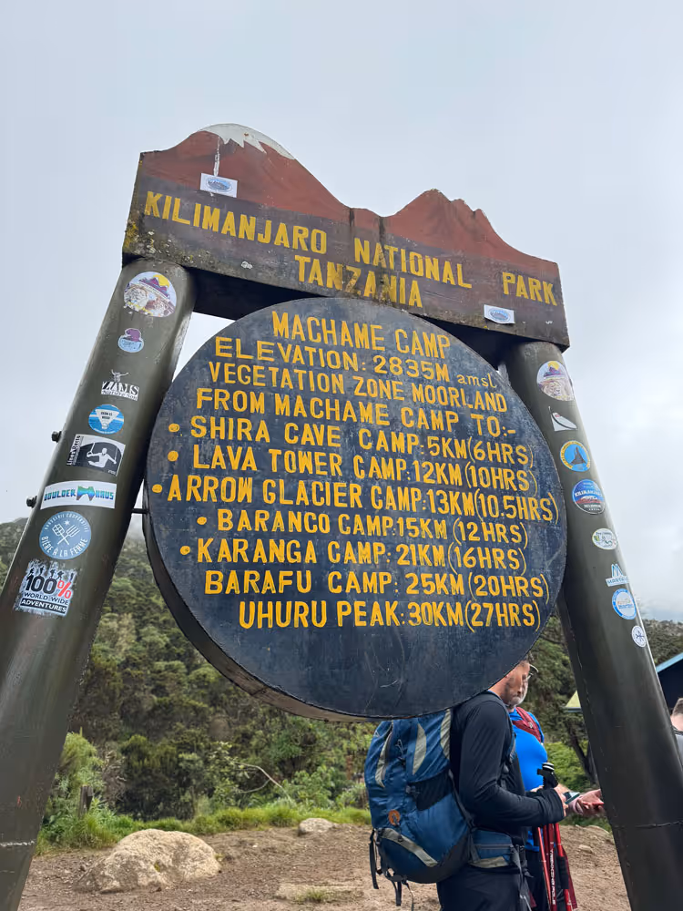
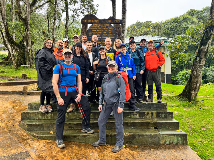
Upon landing in Tanzania you will come out of the airport and Uncharted Summits representatives will be waiting for you. The next 2 days is about relaxation and ensuring you start to focus on the start of your transformational journey up to the roof of Africa. We will have a full safety and mountain briefing, any final questions you may have or wish to ask and then its go time.
Day 1
Londorossi Gate to Shira 1 Camp
Elevation: 2,360m to 3,500m
Distance: 4 km / 2.5 miles | Hiking time: 1–2 hours | Habitat: Rain Forest
Elevation: 2,360m to 3,500m
Distance: 4 km
Trek time: 1-2 hours
Zone: Rainforest
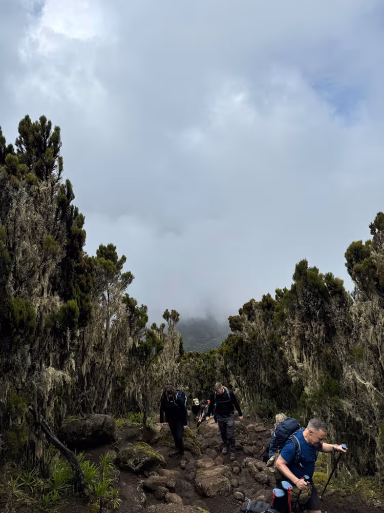
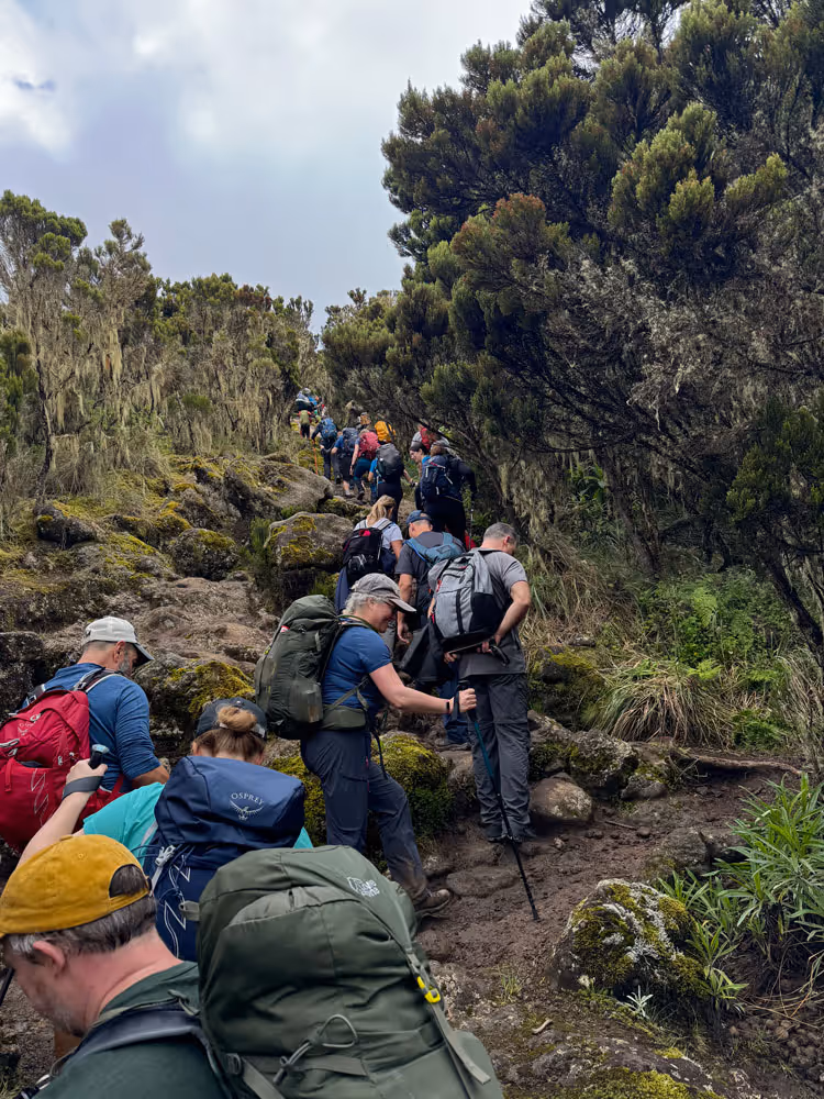
After breakfast, we drive to the Londorossi Park Gate, then transfer in a 4WD vehicle to Lemosho Glades. The first part of the trek takes us through the lush rainforest, where we pass streams and ascend gradually through dense vegetation. As we approach the Shira Ridge, we begin to see glimpses of Kibo across the plateau, marking the start of our incredible ascent. We’ll camp at Shira 1 Camp, with a stunning view of the mountain ahead.
Day 2
Shira 1 Camp to Shira 2 Camp
Elevation: 3,500m to 3,800m
Distance: 7 km / 4 miles | Hiking time: 3–4 hours | Habitat: Heath
Elevation: 3,500m to 3,800m
Distance: 7 km
Trek time: 3-4 hours
Zone: Heath
Today’s trek takes us across the Shira Plateau, with a gentle walk toward Shira 2 Camp. This section offers fantastic views of wildflowers and the distinctive Senecio trees, which are unique to this area. As we walk through this tranquil moorland, we have an excellent opportunity for acclimatization. Along the way, we may spot birds and other wildlife in this relatively untouched area of the mountain.
Day 3
Shira 2 Camp to Lava Tower
Elevation: 3,800m to 4,630m
Distance: 7 km / 4 miles | Hiking time: 3–4 hours | Habitat: Alpine Desert
Elevation: 3,800m to 4,630m
Distance: 7 km
Trek time: 3-4 hours
Zone: Alpine Desert
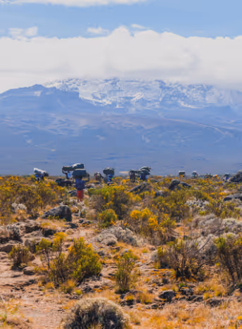
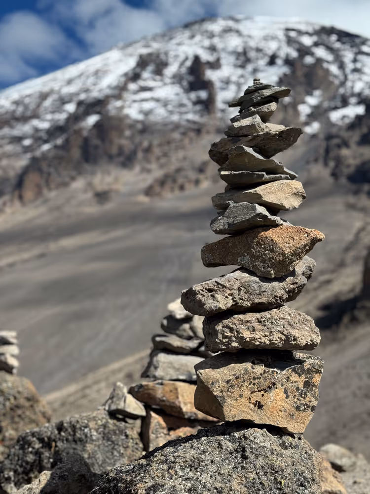
We continue east, ascending towards the Lava Tower, a dramatic 300 ft volcanic rock formation. This is a challenging climb, but the views are rewarding. After reaching Lava Tower, we divert from the main trail to Moir Hut. Moir Hut is situated at the base of Lent Hills and is rarely visited, making it an excellent spot for acclimatization and exploration. This section also offers an opportunity to experience the high-altitude alpine desert, with vast stretches of volcanic rock and sparse vegetation.
Day 4
Moir Hut to Buffalo Camp
Elevation: 4,150m to 4,020m
Distance: 12 km / 7 miles | Hiking time: 5–7 hours | Habitat: Alpine Desert
Elevation: 4,150m to 4,020m
Distance: 12 km
Trek time: 5–7 hours
Zone: Alpine Desert
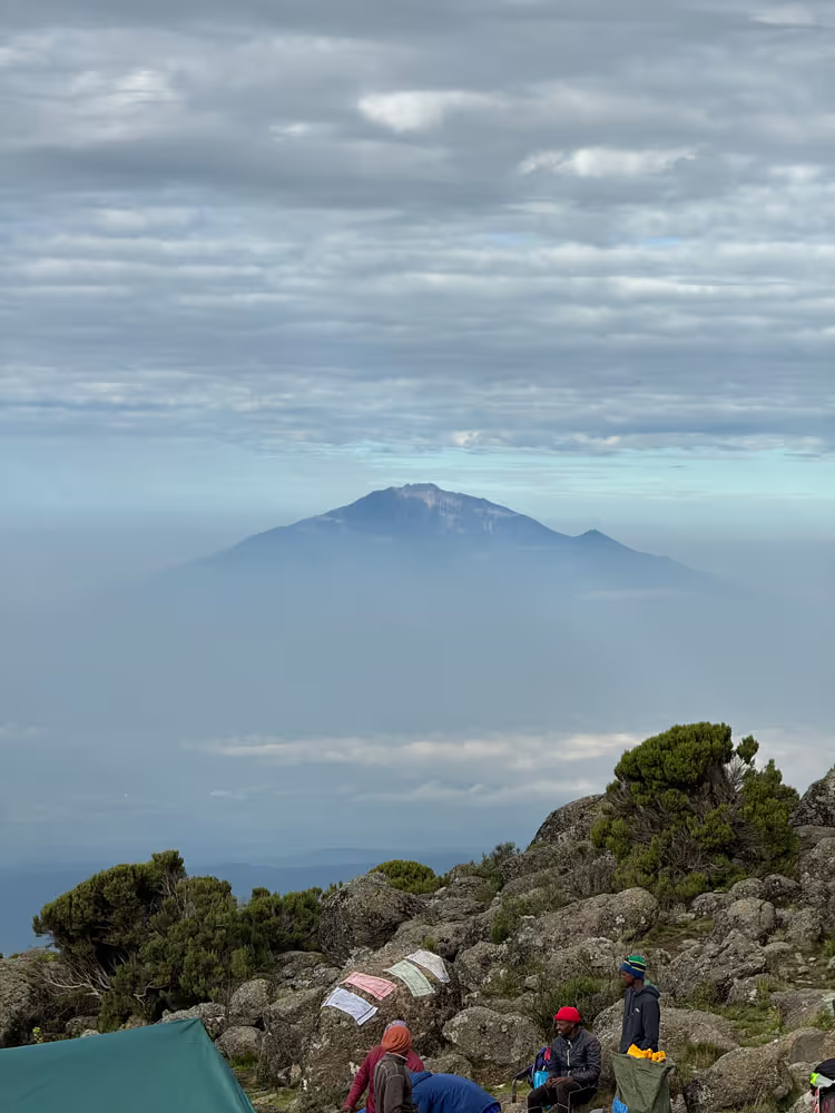
From Moir Hut, we begin with a moderately steep climb, which takes us to the summit of Lent Hills, offering spectacular views over the northern plains of Kilimanjaro. After reaching the top, we descend into a rock field before making our way to Buffalo Camp. The route offers magnificent vistas of the plains stretching to the Kenyan and Tanzanian borders. The dry, rocky terrain of the alpine desert adds to the dramatic beauty of this section of the trek.
Day 5
Buffalo Camp to Third Cave
Elevation: 4,020m to 3,870m
Distance: 8 km / 5 miles | Hiking time: 5–7 hours | Habitat: Heath
Elevation: 4,020m to 3,870m
Distance: 8 km
Trek time: 5-7 hours
Zone: Heath
Today’s trek takes us through the more remote northern slopes of Kilimanjaro. As we head up Buffalo Ridge, the terrain becomes more barren, with fewer signs of vegetation. This rarely used route offers a true sense of wilderness, allowing you to experience Kilimanjaro’s untouched beauty. As we continue, we pass through remote valleys and arrive at Third Cave, where we set up camp for the night. This section is ideal for acclimatization and a peaceful, scenic experience.
Day 6
Third Cave to School Hut
Elevation: 3,870m to 4,750m
Distance: 5 km / 3 miles | Hiking time: 4–5 hours | Habitat: Alpine Desert
Elevation: 3,870m to 4,750m
Distance: 5 km
Trek time: 4-5 hours
Zone: Alpine desert
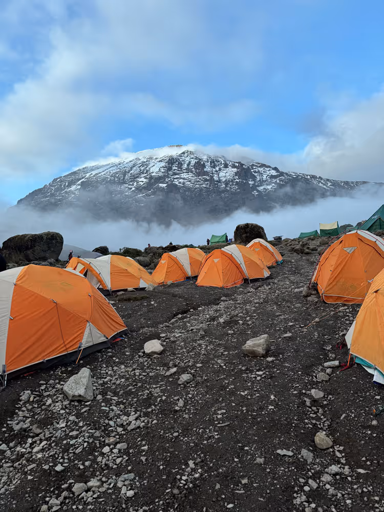
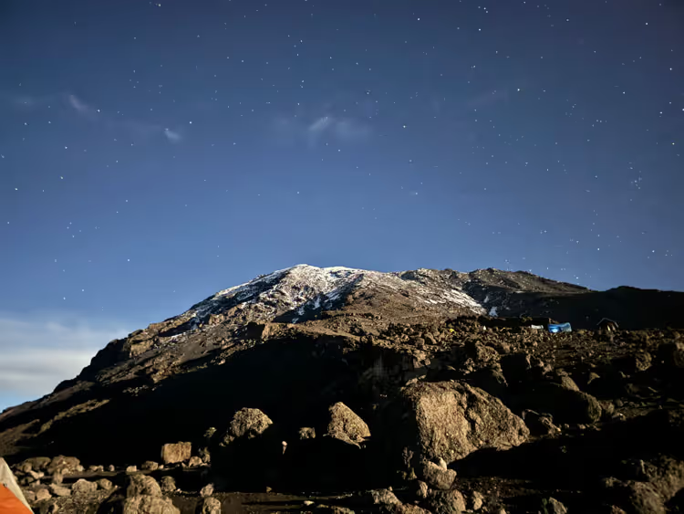
We begin the day with a steady climb over the “Saddle,” the plateau that lies between Kibo and Mawenzi peaks. The terrain here is rocky and exposed, and we’ll continue ascending toward School Hut, our camp for the night. Once we reach the hut, we have time to rest and prepare for the summit day. School Hut is strategically located for an early push toward Uhuru Peak the following morning, and the surrounding views of the barren alpine desert are breathtaking.
Day 7
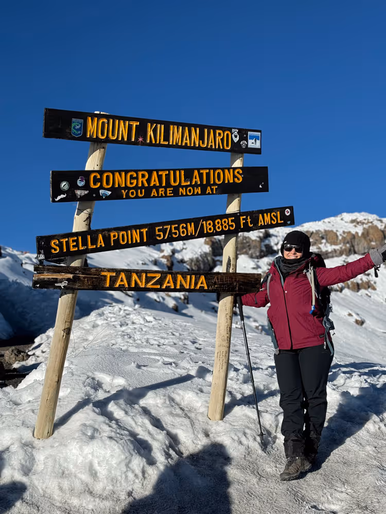
School Hut to Uhuru Peak
Elevation: 4,750m to 5,895m
Distance: 6 km / 4 miles | Hiking time: 6–8 hours | Habitat: Arctic
Elevation: 4,750m to 5,895m
Distance: 6 km
Trek time: 6-8 hours
Zone: Arctic
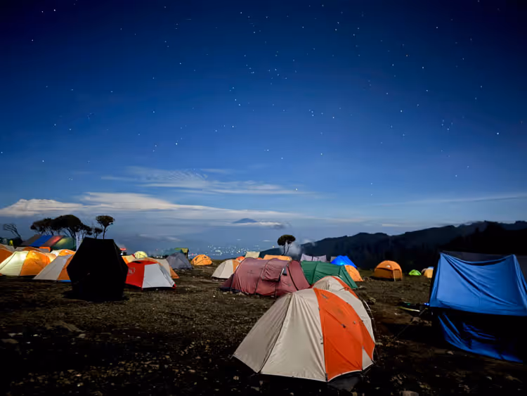
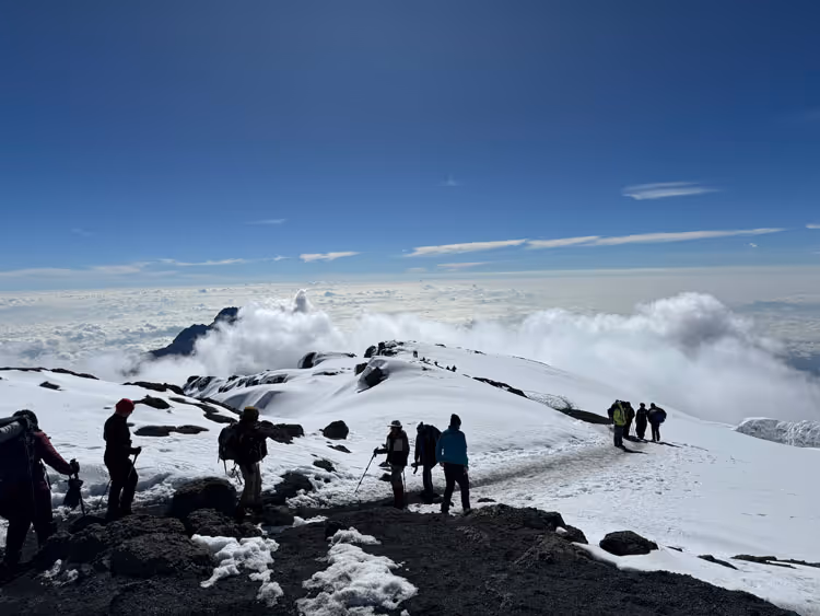
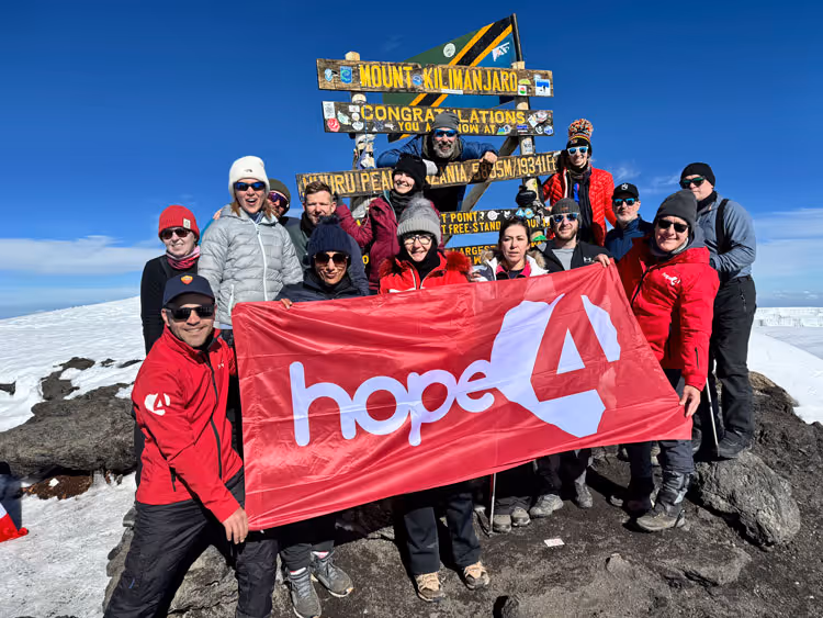
We begin the ascent around midnight, starting the most challenging portion of the trek. The cold and wind at this elevation, coupled with the darkness, makes the climb mentally and physically demanding. After several hours of hiking, we reach Gilman’s Point, where the first rays of sunlight illuminate the stunning views over Mawenzi Peak. From there, we take a short final push to Uhuru Peak, the highest point in Africa. After celebrating at the summit, we begin the descent to Barafu Camp for lunch. The rest of the descent takes us to Millennium Camp for the night, where we can reflect on the incredible achievement.
Day 8
Millennium Camp to Mweka Gate
Elevation: 3,100m to 1,830m
Distance: 10 km / 6 miles | Hiking time: 3–4 hours | Habitat: Rain Forest
Elevation: 3,100m to 1,830m
Distance: 10 km
Trek time: 3-4 hours
Zone: Rainforest
On the final day of the trek, we descend through the lush rainforest towards Mweka Gate. The lower elevations are often wet and muddy, so waterproof gear is recommended. At the gate, we receive our summit certificates and enjoy a celebratory lunch with drinks. From there, we continue to Mweka Village, where we can take a well-deserved hot shower and reflect on the journey before enjoying a final dinner together to celebrate our success.
Post Climb
Celebration and Departure
Distance: 12 km
Trek time: 6–7 hours
Zone: Semi-desert
Celebrate your incredible achievement! After a quiet, reflective bus ride and the best shower of your life, it’s time to come together, receive your summit certificates, and party the night away. The Uncharted Summits team will ensure smooth departures—whether you’re heading home or on to a safari or Zanzibar. Your transformational journey in Tanzania may be ending, but its impact continues long after you return home.
Uncharted Summits
Pre Climb
Arrival in Tanzania
Distance: 12 km
Trek time: 6–7 hours
Zone: Semi-desert
Upon landing in Tanzania you will come out of the airport and Uncharted Summits representatives will be waiting for you. The next 2 days is about relaxation and ensuring you start to focus on the start of your transformational journey up to the roof of Africa. We will have a full safety and mountain briefing, any final questions you may have or wish to ask and then its go time.
Day 1
Londorossi Gate to Mti Mkubwa
Elevation: 2,360m to 2,895m
Distance: 6 km / 4 miles | Hiking Time: 3–4 hours | Habitat: Rain Forest
Elevation: 2,360m to 2,895m
Distance: 6 km
Trek time: 3-4 hours
Zone: Rainforest
We leave Arusha after breakfast and drive approximately four hours to Londorossi Gate for park registration and entry formalities. From there, a short drive takes us to the Lemosho trailhead, where we begin the trek through dense, ancient rainforest. The trail winds uphill beneath a thick canopy alive with birdsong and the occasional monkey sighting. We reach Mti Mkubwa ("Big Tree") Camp in the late afternoon, nestled among lush greenery.
Day 2
Mti Mkubwa to Shira 1 Camp
Elevation: 2,895m to 3,505m
Distance: 8 km / 5 miles | Hiking Time: 5–6 hours | Habitat: Heath
Elevation: 2,895m to 3,505m
Distance: 8 km
Trek time: 5-6 hours
Zone: Heath
Today’s route leads us out of the rainforest and into the heather and moorland zone. We hike through rolling hills and volcanic landscapes, where tall grasses and unique high-altitude flora begin to dominate the terrain. Several stream crossings mark the day’s journey before we climb to Shira Ridge. From here, we descend gently to Shira 1 Camp, situated on a wide plain with the first clear views of Kibo Peak, a dramatic sight as the sun sets over the plateau.
Day 3
Shira 1 Camp to Shira 2 Camp
Elevation: 3,505m to 3,810m
Distance: 7 km / 4 miles | Hiking Time: 3–4 hours | Habitat: Heath
Elevation: 3,505m to 3,810m
Distance: 7 km
Trek time: 3-4 hours
Zone: Heath
Today we continue our gentle acclimatisation across the Shira Plateau, one of the highest in the world. The landscape features vast moorland dotted with unique flora such as Giant Senecio and Lobelia. This scenic walk provides excellent panoramic views and allows the body to adjust gradually to the increasing altitude. We arrive at Shira 2 Camp by early afternoon with time to rest or explore the surroundings before dinner.
Day 4
Shira 2 Camp to Lava Tower
Elevation: 3,810m to 4,630m to 4,140m
Distance: 7 km / 4 miles | Hiking Time: 3–4 hours | Habitat: Alpine Desert
Distance: 7 km / 4 miles | Hiking Time: 2–3 hours | Habitat: Alpine Desert
Elevation: 3,810m to 4,630m to 4,140m
Distance: 14 km
Trek time: 5–7 hours
Zone: Alpine desert
We ascend steadily to Lava Tower, a striking volcanic rock outcrop and a key acclimatisation point. At 4,630m, this is the highest point so far and a test of your altitude readiness. After lunch near the tower, we leave the main trail and head north to the secluded Moir Hut. Set beneath the Lent Hills, this remote camp offers excellent hiking options in the surrounding area, making it a great spot for acclimatisation and reflection.
Day 5
Moir Hut to Buffalo Camp
Elevation: 4,140m to 4,030m
Distance: 12 km / 7 miles | Hiking Time: 5–7 hours | Habitat: Alpine Desert
Elevation: 4,140m to 4,030m
Distance: 12 km
Trek time: 5–7 hours
Zone: Alpine Desert
The day begins with a moderately steep climb out of Moir Valley, with an optional ascent of Lent Hills for panoramic views. We then rejoin the northern circuit trail, crossing over rugged ridges and rock fields. This lesser-travelled route offers solitude and incredible views across the remote northern slopes of Kilimanjaro and out toward the vast Kenyan plains. Buffalo Camp sits in a peaceful, open area with expansive vistas in all directions.
Day 6
Buffalo Camp to Third Cave
Elevation: 4,030m to 3,870m
Distance: 8 km / 5 miles | Hiking Time: 5–7 hours | Habitat: Heath
Elevation: 4,030m to 3,870m
Distance: 8 km
Trek time: 5–7 hours
Zone: Heath
We make our way across Buffalo Ridge and into the northern wilderness of Kilimanjaro. The scenery becomes more desolate and remote, with sparse vegetation and wide open landscapes. Few climbers take this route, so the sense of solitude is profound. We continue through valleys and along ridges to reach Third Cave Camp, a quiet spot offering clear views of the upper slopes and Mawenzi Peak in the distance.
Day 7
Third Cave to School Hut
Elevation: 3,870m to 4,750m
Distance: 5 km / 3 miles | Hiking Time: 4–5 hours | Habitat: Alpine Desert
Elevation: 3,870m to 4,750m
Distance: 5 km
Trek time: 4-5 hours
Zone: Alpine Desert
Today’s steady climb takes us over the "Saddle," a wide, barren expanse of volcanic rock between Kibo and Mawenzi. The terrain is stark and lunar, with very little vegetation. The altitude makes this section physically challenging, but it’s also immensely rewarding. We reach School Hut by early afternoon and spend the rest of the day resting, hydrating, and preparing mentally and physically for the upcoming summit attempt.
Day 8
School Hut to Uhuru Peak
Elevation: 4,750m to 5,895m to 3,070m
Distance: 6 km / 4 miles | Hiking Time: 6–8 hours | Habitat: Arctic
Distance: 12 km / 7 miles | Hiking Time: 4–6 hours | Habitat: Rain Forest
Elevation: 4,750m to 5,895m to 3,070m
Distance: 6km up 12 km down
Trek time: 6–8 hours up 4-6 hours down
Zone: Arctic, Rainforest
We start our summit push just after midnight, ascending slowly through the darkness, guided by headlamps. The route to Gilman’s Point is steep and strenuous, with cold temperatures and thin air. As dawn breaks, we reach the crater rim and continue along it to Uhuru Peak—the highest point in Africa. After a brief celebration and photos at the summit, we begin the descent to Barafu Camp for a rest and lunch, then continue downhill to Mweka Camp for our final night on the mountain.
Day 9
Mweka Camp to Mweka Gate
Elevation: 3,070m to 1,640m
Distance: 10 km / 6 miles | Hiking Time: 3–4 hours | Habitat: Rain Forest
Elevation: 3,070m to 1,640m
Distance: 10 km
Trek time: 3-4 hours
Zone: Rainforest
Our final day begins with a steady descent through rainforest trails, often damp and slippery underfoot. The trail is alive with birds and the sounds of the forest, creating a fitting farewell to the mountain. At Mweka Gate, we receive our certificates and say goodbye to the mountain crew. A vehicle will be waiting to transfer us back to Moshi or Arusha for a celebratory lunch, certificate ceremony, and one last evening together.
Post Climb
Celebration and departure
Distance: 12 km
Trek time: 6–7 hours
Zone: Semi-desert
Celebrate your incredible achievement! After a quiet, reflective bus ride and the best shower of your life, it’s time to come together, receive your summit certificates, and party the night away. The Uncharted Summits team will ensure smooth departures—whether you’re heading home or on to a safari or Zanzibar. Your transformational journey in Tanzania may be ending, but its impact continues long after you return home.